As an underwriter or credit manager, your decision is only as strong as the data you have. In rural lending, you often face incomplete borrower claims, delayed ground reports, and limited visibility into farm health — increasing the risk of delays or defaults. You need clear, verified intelligence at the right time — whether assessing a new loan application or renewing an existing one.
Our Solution – From First Sanction to Final Renewal
ADL’s Agri-Credit Solution, powered by the REAL Maps platform, is designed to give you field-level clarity and confidence at every stage of the loan lifecycle.
It delivers tools that fit seamlessly into your credit workflow:

For banks, NBFCs, and agri-credit teams, REAL Maps supports faster appraisal, better field visibility, portfolio monitoring, and informed renewal decisions.
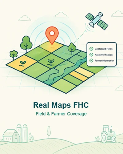
REAL Maps – FHC (Farm Health Card)
When you assess a fresh loan application:
- See the borrower’s farm as it is today — geo-tagged, mapped to verified survey boundaries.
- Get accurate cropping details — type, acreage, sowing date, growth stage, and quality.
- Access ownership and administrative data instantly — no waiting for physical verification.
- Receive a comprehensive Farm Health Card report or pull data directly into your system via API.
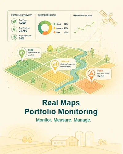
REAL Maps – Portfolio Management
REAL’s GIS-enabled portfolio warehouse offers a consolidated, map-based view of your entire agri-lending portfolio. At renewal, this is supported by REAL Maps – Portfolio Monitoring reports, providing:
- Year/Season Summary – Full farm performance across the credit cycle.
- Risk Assessment – Flags underperforming or distressed borrowers.
- Asset Verification – Confirms ongoing control of verified farm assets.

For agriculture insurance workflows, REAL Maps supports farm verification, crop monitoring, risk indicators, claim-support intelligence, and portfolio-level visibility.
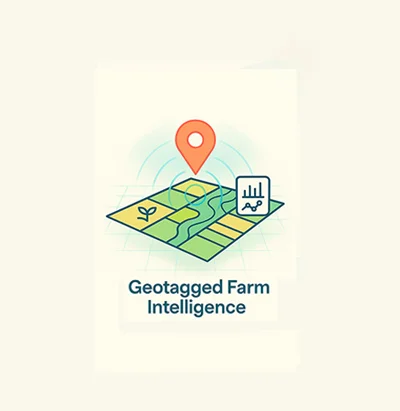
Farm Verification
Geo-tagged farm intelligence helps insurance teams verify farm location, boundary context, and borrower or farmer-level details before policy or claim decisions.
- Farm location verification
- Boundary and survey context
- Reduced manual dependency

Crop Monitoring
Crop monitoring gives visibility into crop type, acreage, sowing, growth stage, and quality so insurance workflows can be supported with consistent field intelligence.
- Crop type and acreage visibility
- Sowing and growth-stage monitoring
- Quality indicators for review
Risk Indicators
Risk indicators help insurers identify distressed crops, underperforming areas, and field-level anomalies that may require review or follow-up.
- Distress and underperformance flags
- Field-level anomaly visibility
- Risk review inputs
Claim Support
Farm and crop intelligence can support claim review by giving teams a clearer evidence layer for field condition, season performance, and verified asset context.
- Evidence layer for claim review
- Farm and crop status context
- Support for faster assessment
Portfolio Intelligence
Portfolio-level intelligence helps insurance teams review farms, crop exposure, and area-level trends from a consolidated geospatial view.
- Consolidated geospatial portfolio view
- Crop exposure visibility
- Area-level monitoring support
Contact Us
Ready to Strengthen Your Agri-Credit Decisions?
Discover how ADL and REAL Maps can help banks and NBFCs use geo-verified farm intelligence for faster, safer lending workflows.